Skip to content
Political Maps

Political Maps

collection of maps of election results and political trends

  • 2016
  • 2012
  • 2008
  • 2004
  • 2000

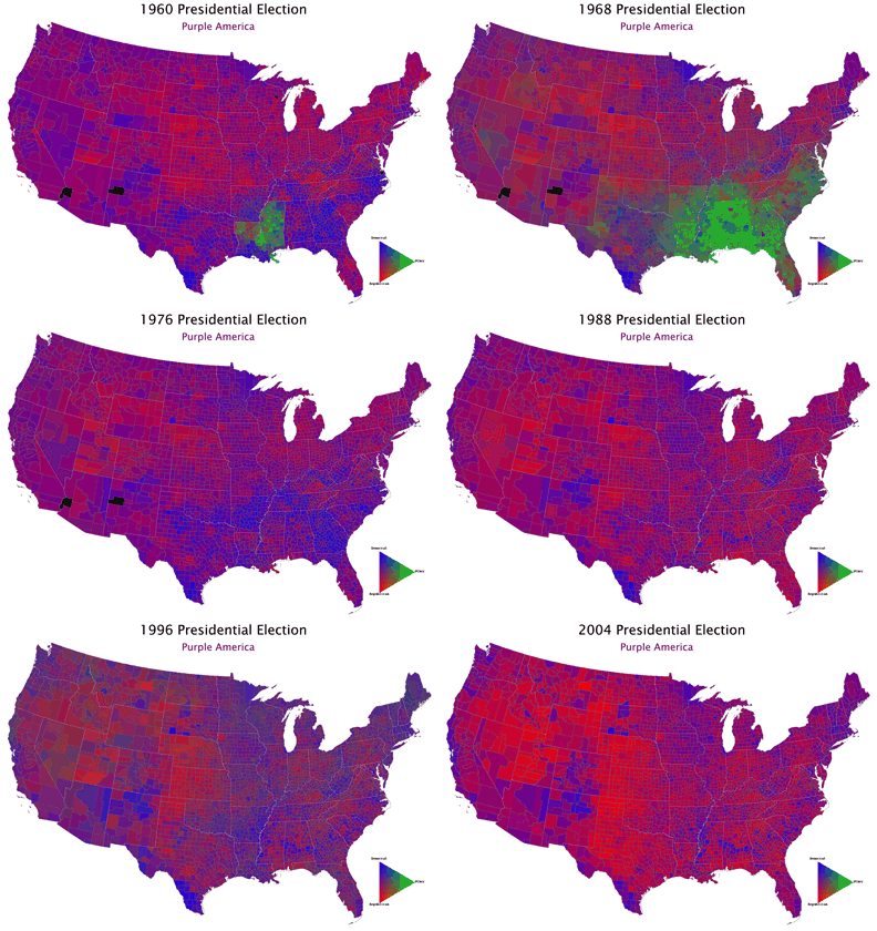
Red States + Blue States = Purple Nation

November 20, 2007

The pundits constantly refer to Red States and Blue States, but the reality is that the nation is Purple as illustrated by Robert J. Vanderbei’s maps.

Post navigation

Contact Your Senators

Related Post

How Large Is the Divide Between Red and Blue America?

November 5, 2016

After decades of Republican victories, here’s how California became a blue state again

November 3, 2016

AJC: How Georgia went from blue to red

October 18, 2016
Political Maps

Political Maps

collection of maps of election results and political trends

Proudly powered by WordPress | Theme: Newsup by Themeansar.

  • Home
  • About
  • Archives
  • Privacy Policy
  • Sample Page
  • Sitemap