Skip to content
Political Maps

Political Maps

collection of maps of election results and political trends

  • 2016
  • 2012
  • 2008
  • 2004
  • 2000

Historical US Presidential Elections Interactive 1920-2012

July 21, 2016

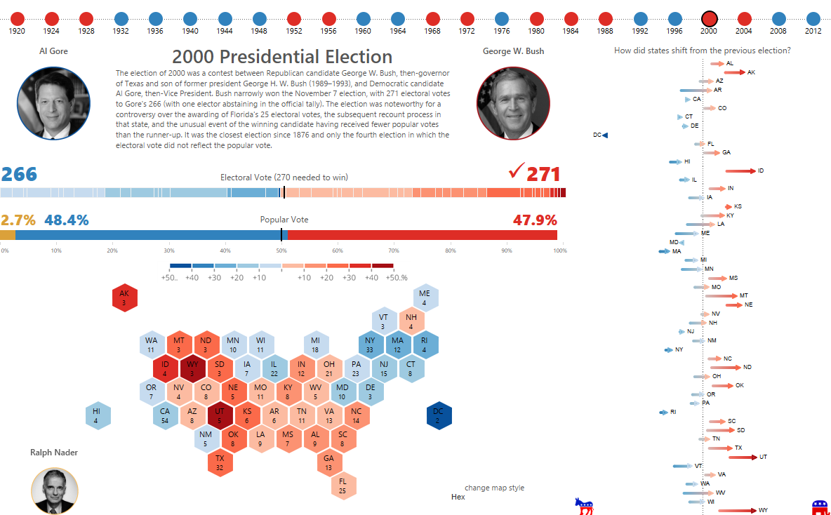
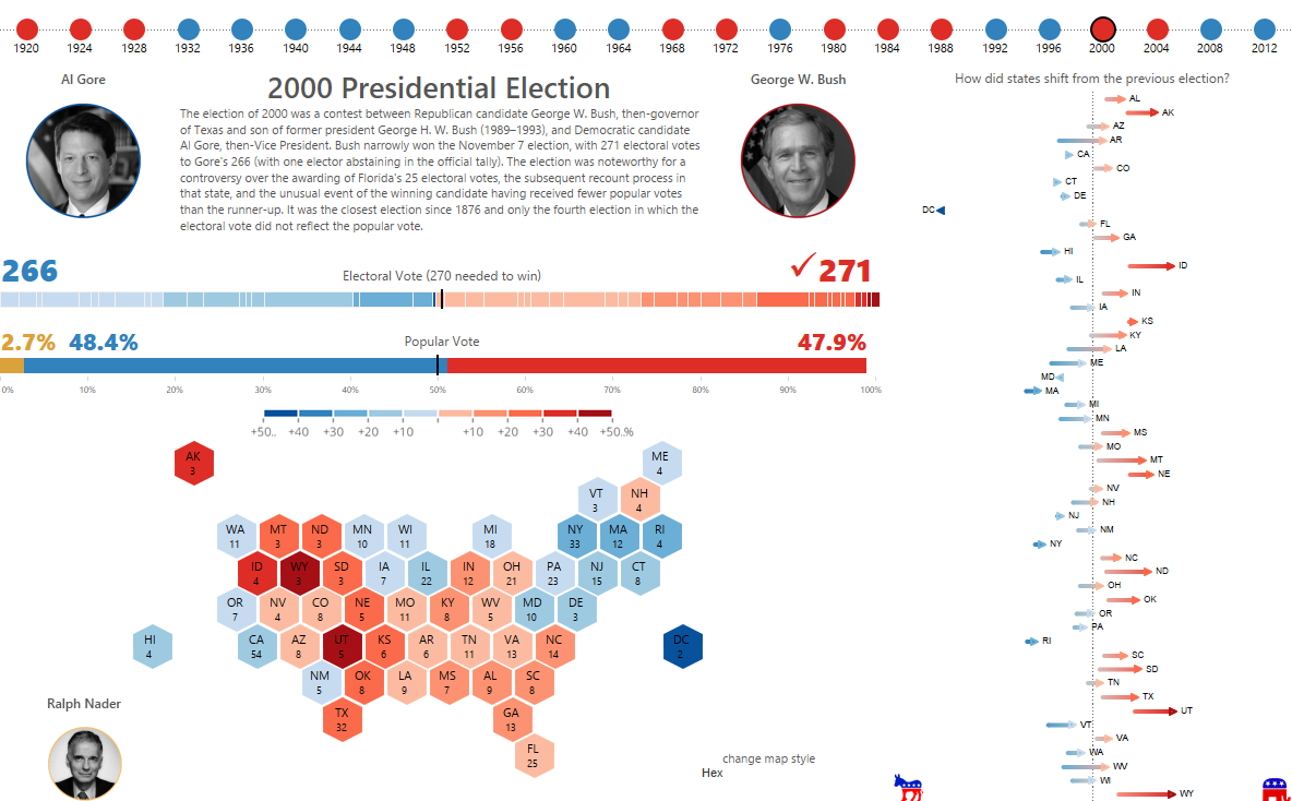
Jacob Olsufka has created an interactive look back at all of the presidential elections in US since 1920. A few examples are below, but be sure to check out the interactive version at Tableau.com.
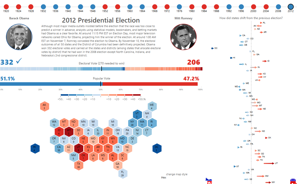
Election
Election (1)
Election (2)
Election (3)

Post navigation

The Road Map to the White House
Vox: 23 maps that explain how Democrats went from the party of racism to the party of Obama

Related Post

What one swing state can teach us about political polarization in America

November 6, 2016

How Large Is the Divide Between Red and Blue America?

November 5, 2016

After decades of Republican victories, here’s how California became a blue state again

November 3, 2016
Political Maps

Political Maps

collection of maps of election results and political trends

Proudly powered by WordPress | Theme: Newsup by Themeansar.

  • Home
  • About
  • Archives
  • Privacy Policy
  • Sample Page
  • Sitemap